ReNews Pakistan is a dedicated digital news platform focused exclusively
on real estate, urban development, infrastructure, and property markets
across Pakistan. It delivers timely updates, policy developments, market
insights, and ground realities shaping the country’s land and housing sector.
The platform is structured into
news categories, regional coverage, corporate updates,
and research-based analysis to ensure accurate,
transparent, and sector-specific reporting.
Larkana is a historic city located in Larkana District, Sindh, Pakistan. It lies northwest of Hyderabad and is connected by road and railway networks. The city is known for its political significance and proximity to the ancient site of Mohenjo-Daro.
Important Updates from Larkana Tehsil
Real Estate & Land News
Published: September 3, 2026 at 12:01 AM
Larkana: SUPARCO Satellite Report Reveals Indus River Nearing Flood Protection Bund, Raising Risks to Residential Areas and Farmland
لاڑکانہ: سپارکو کی سیٹلائٹ رپورٹ میں دریا کا سیلابی بند کے قریب پہنچنے کا انکشاف، رہائشی علاقوں اور زرعی زمین کو خطرات بڑھ گئے
▫️Experts say lessons from past floods have not been adequately incorporated into land use policies and urban planning
▫️ماضی کے سیلابوں سے حاصل ہونے والے اسباق کو زمین کے استعمال اور شہری منصوبہ بندی میں مناسب طور پر شامل نہیں کیا گیا: ماہرین
Larkana | ReNews PakistanThe rapidly shifting course of the Indus River near Larkana has raised serious concerns over the safety...
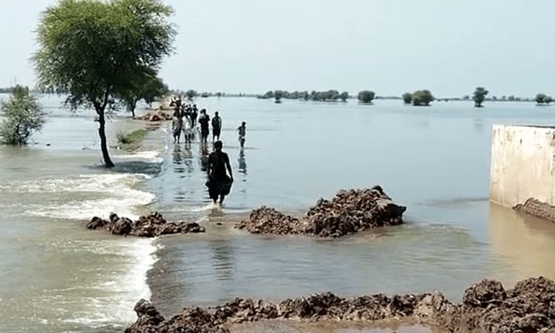
Larkana | ReNews Pakistan The rapidly shifting course of the Indus River near Larkana has raised serious concerns over the safety of residential areas, agricultural land, property investments and future housing developments, as a SUPARCO satellite analysis shows that the river’s active channel has shifted by approximately 4.5 kilometres over the past 35 years. According to the SUPARCO satellite analysis, a significant change has been recorded in the flow of the Indus near the Moria Loop Bund, east of Larkana city. The changing river course has brought the active channel closer to a critical section of the flood protection bund, increasing the risk of breaches during severe flooding or exceptionally high river flows. The situation also presents a major challenge for Pakistan’s property and urban planning sectors, particularly at a time when the country is facing a severe housing shortage. According to figures cited from the State Bank of Pakistan, the country faces a housing deficit of around 10 million units, with the shortfall increasing by approximately 350,000 units every year. Experts warn that housing expansion without considering floodplains, river corridors and natural drainage routes could expose thousands of families, as well as billions of rupees invested in property and infrastructure, to significant future risks. The devastating floods of 2010 provide a historical example of such vulnerabilities. Proceedings of the Flood Commission constituted by the Supreme Court of Pakistan highlighted how the expansion of settlements and construction along river corridors had significantly obstructed the natural flow of floodwaters, contributing to widespread destruction across several districts. At the Tori Bund site, several new settlements and fish ponds had been established within the loop area. These developments were among the factors associated with the subsequent catastrophic breach of the bund. The resulting floods affected large parts of Sindh, forcing residents to evacuate and causing extensive damage to homes, agricultural land and livelihoods. Water resources expert Zulfiqar Ali Halepoto has pointed to the continued expansion of development activities in riverine areas, saying that lessons learned from past floods have not been adequately incorporated into land-use policies and urban planning. Recent satellite observations around the Moria and Aqeel Loop Bund areas indicate that approximately 2,000 hectares of land along the left bank of the Indus have been eroded and lost to the river. This erosion has reduced the area of agricultural and floodplain land while bringing the active river channel closer to the existing protective bund. Meanwhile, sediment and sand deposition along the opposite bank has created approximately 1,600 hectares of new potentially cultivable land. However, experts caution that this newly formed land remains vulnerable and temporary in nature because the river could change course again in the future. It therefore cannot be considered safe for permanent agricultural use or property development without a proper risk assessment. The threat is not limited to Larkana. A comparative review of 2025 satellite imagery from the Latifabad area of Hyderabad further indicates that urban expansion has encroached upon parts of the natural riverine protection belt. Areas that once consisted of agricultural and open land, providing natural space for absorbing rainwater and allowing excess floodwater to spread, have increasingly been replaced by permanent residential structures, roads and other infrastructure. Construction across natural floodplains can restrict the pathways available for excess water generated by intense monsoon rainfall or by increased flows resulting from snow and glacier melt in upstream areas. This can raise water levels and flow velocities while increasing pressure on protective bunds and nearby settlements. A further comparison of satellite images of Larkana from 1990 and 2025 highlights the growing interaction between the changing course of the Indus and urban expansion. In 1990, the river’s main channel passed several kilometres away from the flood protection bund, following a broad curve. Over time, erosion and sediment deposition have caused the main channel to shift eastward. The danger is no longer limited to floodwaters overtopping the bund. Continued erosion and the washing away of soil beneath the structure could also weaken its foundation. In the event of a sudden breach, floodwaters could rapidly enter nearby residential and agricultural areas, leaving limited time for evacuation and potentially causing severe damage to homes, land and critical infrastructure. The situation underscores the need to make formal flood risk assessments a mandatory component of approvals for new housing schemes and urban expansion. Experts say that instead of approving housing projects solely on the basis of land availability and rising residential demand, urban planning must also incorporate the natural flow of rivers, floodplains, drainage systems and environmental risks. A risk sensitive approach to land-use planning, experts stress, is essential to protect communities, agricultural assets and property investments from the growing threat posed by changing river courses and extreme flood events.
لاڑکانہ | ری نیوز پاکستان لاڑکانہ کے قریب دریائے سندھ کے تیزی سے رخ بدلنے نے گھروں، زرعی اراضی، پراپرٹی سرمایہ کاری اور مستقبل کی ہاؤسنگ ڈویلپمنٹ کے تحفظ کے حوالے سے سنگین خدشات پیدا کر دیے ہیں، جہاں سپارکو کے سیٹلائٹ تجزیے کے مطابق گزشتہ 35 برس کے دوران دریا کا فعال بہاؤ تقریباً 4.5 کلومیٹر تک منتقل ہو چکا ہے۔
سپارکو کے سیٹلائٹ تجزیے کے مطابق لاڑکانہ شہر کے مشرق میں موریا لوپ بند کے قریب دریائے سندھ کے بہاؤ میں نمایاں تبدیلی ریکارڈ کی گئی ہے۔ دریا کے بدلتے رخ نے اسے سیلاب سے بچاؤ کے اہم بند کے ایک حساس حصے کے قریب پہنچا دیا ہے، جس سے شدید سیلاب یا غیر معمولی بلند بہاؤ کے دوران بند میں شگاف پڑنے کا خطرہ بڑھ گیا ہے۔
صورتحال پاکستان کے پراپرٹی اور شہری منصوبہ بندی کے شعبے کے لیے بھی اہم چیلنج بن گئی ہے، خصوصاً ایسے وقت میں جب ملک کو شدید ہاؤسنگ بحران کا سامنا ہے۔ اسٹیٹ بینک آف پاکستان کے حوالے سے پیش کیے گئے اعداد و شمار کے مطابق ملک میں تقریباً ایک کروڑ گھروں کی کمی ہے، جبکہ یہ خلا ہر سال تقریباً 3 لاکھ 50 ہزار یونٹس کی رفتار سے بڑھ رہا ہے۔
ماہرین کا کہنا ہے کہ سیلابی میدانوں، دریائی گزرگاہوں اور قدرتی نکاسی آب کے راستوں کو مدنظر رکھے بغیر ہاؤسنگ میں توسیع ہزاروں خاندانوں اور پراپرٹی و انفراسٹرکچر میں لگائی گئی اربوں روپے کی سرمایہ کاری کو مستقبل میں بڑے خطرات سے دوچار کر سکتی ہے۔
اس خطرے کی تاریخی مثال 2010 کا تباہ کن سیلاب ہے۔ سپریم کورٹ آف پاکستان کی جانب سے تشکیل دیے گئے فلڈ کمیشن کی کارروائی میں یہ بات سامنے آئی تھی کہ دریائی گزرگاہوں کے ساتھ شہری آبادی اور تعمیرات میں توسیع نے سیلابی پانی کے قدرتی بہاؤ میں نمایاں رکاوٹ پیدا کی، جس کے باعث کئی اضلاع میں بڑے پیمانے پر تباہی ہوئی۔
ٹوری بند کے مقام پر لوپ بند کے اندر متعدد نئی آبادیاں اور مچھلی کے تالاب قائم کیے گئے تھے، جو بعد ازاں تباہ کن بند ٹوٹنے کے واقعے کا سبب بننے والے عوامل میں شامل رہے۔ اس کے نتیجے میں سندھ کے بڑے حصے میں سیلابی صورتحال پیدا ہوئی، شہریوں کو نقل مکانی کرنا پڑی اور گھروں، زرعی زمین اور روزگار کو بھاری نقصان پہنچا۔
ماہر آبی وسائل ذوالفقار علی ہالیپوٹو نے دریائی علاقوں میں ترقیاتی سرگرمیوں کے تسلسل کی نشاندہی کرتے ہوئے کہا ہے کہ ماضی کے سیلابوں سے حاصل ہونے والے اسباق کو زمین کے استعمال اور شہری منصوبہ بندی میں مناسب طور پر شامل نہیں کیا گیا۔
موریا اور عقیل لوپ بند کے اطراف حالیہ سیٹلائٹ مشاہدات کے مطابق دریائے سندھ کے بائیں کنارے سے تقریباً 2 ہزار ہیکٹر اراضی دریا برد ہو چکی ہے۔ اس کٹاؤ کے باعث زرعی اور سیلابی میدان کا رقبہ کم ہوا ہے جبکہ دریا کا فعال بہاؤ موجودہ حفاظتی بند کے مزید قریب آ گیا ہے۔
دوسری جانب دریا کے مخالف کنارے پر مٹی اور ریت جمع ہونے سے تقریباً 1,600 ہیکٹر نئی قابلِ کاشت زمین وجود میں آئی ہے۔ تاہم ماہرین کے مطابق یہ نئی زمین دریا کے مستقبل میں دوبارہ رخ بدلنے کے باعث غیر محفوظ اور عارضی نوعیت کی ہے، اس لیے اسے مستقل یا کم خطرے والی زرعی یا پراپرٹی ڈویلپمنٹ کے لیے محفوظ تصور نہیں کیا جا سکتا۔
خطرہ صرف لاڑکانہ تک محدود نہیں۔ مزید نیچے حیدرآباد کے لطیف آباد کے علاقے کی 2025 کی سیٹلائٹ تصاویر کے تقابلی جائزے سے ظاہر ہوتا ہے کہ شہری پھیلاؤ نے قدرتی دریائی حفاظتی پٹی کے بعض حصوں کو بھی تعمیرات کی زد میں لے لیا ہے۔
وہ علاقے جہاں پہلے زرعی زمین اور کھلی اراضی موجود تھی اور جو بارش یا سیلابی پانی کو جذب کرنے کے ساتھ ساتھ اضافی پانی کے پھیلاؤ کے لیے قدرتی جگہ فراہم کرتے تھے، اب وہاں مستقل رہائشی تعمیرات، سڑکیں اور دیگر انفراسٹرکچر قائم ہو چکے ہیں۔
قدرتی سیلابی میدانوں میں تعمیرات کے باعث شدید مون سون بارشوں یا بالائی علاقوں سے برف اور گلیشیئرز کے پگھلنے کے نتیجے میں آنے والے اضافی پانی کے لیے قدرتی راستے محدود ہو سکتے ہیں۔ اس صورتحال سے پانی کی سطح اور بہاؤ کی رفتار بڑھنے کے ساتھ حفاظتی بندوں اور قریبی آبادیوں پر دباؤ میں اضافہ ہو سکتا ہے۔
لاڑکانہ کی 1990 اور 2025 کی سیٹلائٹ تصاویر کا ایک اور تقابلی جائزہ بھی دریائے سندھ کے بدلتے راستے اور شہری پھیلاؤ کے درمیان بڑھتے خطرے کی نشاندہی کرتا ہے۔ 1990 میں دریا کا مرکزی بہاؤ فلڈ پروٹیکشن بند سے کئی کلومیٹر کے فاصلے پر ایک وسیع خم کے ساتھ گزر رہا تھا، تاہم وقت کے ساتھ دریا کے کٹاؤ اور مٹی کے جمع ہونے کے باعث اس کا مرکزی بہاؤ مشرق کی جانب منتقل ہو گیا۔
اب خطرہ صرف سیلابی پانی کے بند سے اوپر گزرنے تک محدود نہیں بلکہ مسلسل کٹاؤ اور زمین کے نیچے سے مٹی بہہ جانے کے باعث بند کی بنیاد کمزور ہونے کا خدشہ بھی موجود ہے۔ اچانک بند ٹوٹنے کی صورت میں قریبی رہائشی اور زرعی علاقوں میں تیزی سے سیلابی پانی داخل ہو سکتا ہے، جس سے انخلا کے لیے محدود وقت ملے گا اور گھروں، زمین اور بنیادی ڈھانچے کو شدید نقصان پہنچ سکتا ہے۔
موجودہ صورتحال اس امر کی ضرورت کو اجاگر کرتی ہے کہ نئی ہاؤسنگ سکیموں اور شہری توسیع کی منظوری میں سیلاب کے خطرات کا باقاعدہ جائزہ شامل کیا جائے۔ ماہرین کے مطابق صرف دستیاب زمین اور بڑھتی ہوئی رہائشی طلب کو بنیاد بنا کر ہاؤسنگ منصوبے شروع کرنے کے بجائے دریاؤں کے قدرتی بہاؤ، سیلابی میدانوں، نکاسی آب کے نظام اور ماحولیاتی خطرات کو بھی شہری منصوبہ بندی کا لازمی حصہ بنایا جانا چاہیے۔
Published: March 18, 2026 at 11:39 AM
Mohenjo Daro Coins Yet to Be Sent for Testing Despite Decision
موہنجو داڑو سے ملنے والے سکے تاحال لیبارٹری نہ بھجوائے جا سکے
▫️Delay Raises Concerns Over Preservation and Authentication of Artefacts
▫️تاخیر پر ماہرین کا تحفظات کا اظہار، آثار کی جانچ کا عمل رکاوٹ کا شکار
Larkana: ReNews Pakistan Despite a decision taken in January to send a cluster of coins discovered at the Mohenjo-Daro archaeological...
Larkana: ReNews Pakistan
Despite a decision taken in January to send a cluster of coins discovered at the Mohenjo-Daro archaeological site to a laboratory in Karachi for age determination, the artefacts are still lying at the site, raising concerns among experts regarding their preservation and timely analysis.
According to sources, the coins were unearthed during excavation activities at the historic site and were initially believed to hold significant archaeological value. Authorities had decided to dispatch them to a specialised laboratory in Karachi to conduct scientific testing and authentication, which would help determine their historical period and origin.
However, despite the passage of several weeks, the artefacts have not yet been transported and remain at Mohenjo-Daro under local supervision. Experts have expressed concern that delays in testing could affect both the preservation of the coins and the accuracy of research findings.
Officials from the relevant department have cited administrative and logistical hurdles as reasons for the delay, stating that arrangements for secure transportation and proper documentation are still being finalised.
Archaeologists have stressed the importance of prompt scientific examination, noting that such artefacts could provide valuable insights into the region’s historical timeline and trade practices. They have urged authorities to expedite the process to ensure the artefacts are preserved and studied under controlled conditions.
Mohenjo-Daro, a UNESCO World Heritage Site, remains one of the most significant centres of the Indus Valley Civilisation, and discoveries at the site continue to attract both national and international attention.
لاڑکانہ: ری نیوز پاکستان
موہنجو داڑو کے آثارِ قدیمہ کے مقام سے دریافت ہونے والے سکوں کے ایک مجموعے کو عمر کے تعین کیلئے کراچی کی لیبارٹری بھجوانے کا جنوری میں کیا گیا فیصلہ تاحال عملی شکل اختیار نہ کر سکا، اور یہ نوادرات اب بھی جائے دریافت پر موجود ہیں، جس پر ماہرین نے تشویش کا اظہار کیا ہے۔
یہ سکے حالیہ کھدائی کے دوران برآمد ہوئے تھے اور ابتدائی طور پر انہیں اہم تاریخی حیثیت کا حامل قرار دیا گیا۔ حکام نے ان کی سائنسی جانچ اور تصدیق کیلئے کراچی کی ایک مستند لیبارٹری منتقل کرنے کا فیصلہ کیا تھا تاکہ ان کی اصل عمر اور تاریخی پس منظر کا تعین کیا جا سکے۔
تاہم کئی ہفتے گزرنے کے باوجود یہ نوادرات ابھی تک موہنجو داڑو ہی میں موجود ہیں، جس سے ان کی محفوظ منتقلی اور بروقت تحقیق کے حوالے سے سوالات اٹھ رہے ہیں۔ ماہرین آثارِ قدیمہ کا کہنا ہے کہ تاخیر سے نہ صرف تحقیق کا عمل متاثر ہو سکتا ہے بلکہ نوادرات کے محفوظ رہنے پر بھی اثر پڑ سکتا ہے۔
متعلقہ حکام کے مطابق تاخیر کی وجہ انتظامی اور لاجسٹک مسائل ہیں، جبکہ محفوظ نقل و حمل اور دستاویزی کارروائیوں کو حتمی شکل دی جا رہی ہے۔
ماہرین نے زور دیا ہے کہ ان سکوں کی جلد از جلد سائنسی جانچ ضروری ہے کیونکہ یہ دریافت خطے کی تاریخ، تجارت اور تہذیبی روابط کے بارے میں اہم معلومات فراہم کر سکتی ہے۔
موہنجو داڑو، جو کہ وادیٔ سندھ کی تہذیب کا ایک اہم مرکز اور عالمی ثقافتی ورثہ ہے، سے ہونے والی ہر نئی دریافت ملکی و بین الاقوامی سطح پر غیر معمولی اہمیت رکھتی ہے۔
 CENTRAL
8 SECTIONS
CENTRAL
8 SECTIONS