

Governs agency overseeing land revenue, territorial boundaries, and land-related matters.
Punjab Land Records Authority
Providing citizens with property records, updating, and administration of Punjab and its rural land.
Provincial Housing & Town Planning Department
Managing urban development, housing policies, & town planning initiatives.
Punjab Urban Unit
Conducting research, data analysis, & urban management solutions.
Important Updates from Punjab
Real Estate & Land News
Published: August 20, 2026 at 5:10 PM
Bhatti Chowk Underpass Opens to Traffic, Easing Congestion Around Lahore’s Data Darbar
بھٹی چوک انڈر پاس ٹریفک کیلئے کھول دیا گیا، داتا دربار کے اطراف ٹریفک دباؤ میں کمی
▫️Newly completed underpass becomes operational after four months of construction, providing a new traffic route through one of Lahore’s busiest inner-city areas
▫️چار ماہ میں مکمل ہونے والا انڈر پاس فعال، لاہور کے مصروف اندرونِ شہر میں گاڑیوں کیلئے نئی گزرگاہ دستیاب
Lahore : ReNews PakistanThe newly constructed Bhatti Chowk Underpass has been opened to traffic after being completed in four months,...
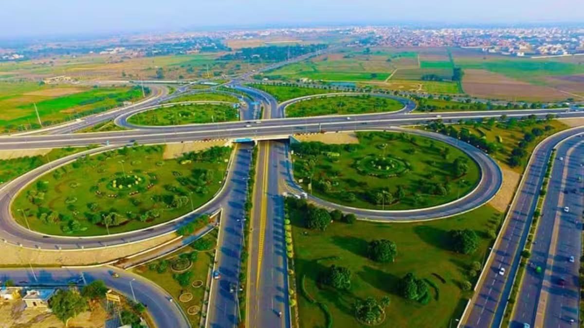
Lahore : ReNews Pakistan The newly constructed Bhatti Chowk Underpass has been opened to traffic after being completed in four months, providing motorists with a new route aimed at easing chronic congestion around Data Darbar and Lahore’s densely populated Inner City. According to the Punjab government, the project was undertaken to address long-standing traffic bottlenecks at Bhatti Chowk, an important junction used by large numbers of commuters, public transport vehicles and commercial traffic travelling through the historic parts of Lahore. With the underpass now operational, vehicles can move through the area without facing some of the delays previously caused by heavy traffic at the junction. The government says the project is expected to improve overall traffic circulation around Data Darbar and adjoining roads. Bhatti Chowk serves as a major gateway to several parts of Lahore’s historic core and regularly experiences significant traffic pressure. Congestion in the area has traditionally resulted in longer travel times, particularly during peak hours and periods of increased activity around Data Darbar. The Punjab government said the underpass has significantly reduced the time required to cross the congested section. According to a citizen quoted following the opening, travelling through the area previously took around 10 to 15 minutes, while the same journey can now be completed in approximately two to three minutes. The reduction in travel time is expected to benefit not only private motorists but also public transport operators, commercial vehicles and commuters who regularly travel through the area. Citizens and transporters have welcomed the opening of the underpass, particularly its completion within a relatively short construction period. The project was completed in four months and has now been made fully available for vehicular traffic. The Punjab government described the scheme as part of its broader efforts to improve urban mobility and public infrastructure in Lahore. It said the project was completed in line with the public-service vision of Chief Minister Punjab Maryam Nawaz Sharif and former prime minister Nawaz Sharif. Beyond reducing congestion at Bhatti Chowk itself, improved movement through the junction could also help ease traffic pressure on surrounding roads by reducing queues and delays at a key inner-city intersection. The opening adds another major traffic infrastructure facility to Lahore at a time when the provincial government is undertaking a number of road improvement, remodelling and traffic management projects across the city. With the Bhatti Chowk Underpass now open, authorities expect smoother movement through the Data Darbar area and shorter journey times for thousands of commuters using the route daily.
لاہور : ری نیوز پاکستان لاہور کے مصروف ترین علاقوں میں شامل بھٹی چوک پر نیا تعمیر شدہ انڈر پاس چار ماہ میں مکمل ہونے کے بعد ٹریفک کیلئے کھول دیا گیا ہے، جس سے داتا دربار اور اندرونِ شہر کے گرد طویل عرصے سے جاری ٹریفک دباؤ میں کمی کی توقع ہے۔ پنجاب حکومت کے مطابق منصوبہ بھٹی چوک پر مسلسل ٹریفک جام کے مسئلے سے نمٹنے کیلئے شروع کیا گیا تھا۔ یہ اہم چوراہا روزانہ بڑی تعداد میں شہریوں، پبلک ٹرانسپورٹ اور تجارتی گاڑیوں کی آمدورفت کیلئے استعمال ہوتا ہے، خصوصاً لاہور کے تاریخی اندرونِ شہر جانے اور وہاں سے واپس آنے والی ٹریفک کا بڑا حصہ اسی راستے سے گزرتا ہے۔ انڈر پاس کھلنے کے بعد گاڑیاں اب چوک پر طویل انتظار کے بغیر علاقے سے گزر سکیں گی۔ حکومت کا کہنا ہے کہ منصوبے سے داتا دربار اور ملحقہ سڑکوں پر ٹریفک کی روانی بہتر ہوگی اور رش کے اوقات میں گاڑیوں کی قطاریں کم کرنے میں مدد ملے گی۔ بھٹی چوک لاہور کے تاریخی مرکز کے مختلف علاقوں تک رسائی کا ایک اہم داخلی راستہ ہے، جہاں خاص طور پر رش کے اوقات اور داتا دربار میں زیادہ آمدورفت کے دوران شدید ٹریفک دباؤ معمول رہا ہے۔ پنجاب حکومت کے مطابق انڈر پاس کے فعال ہونے سے اس مصروف حصے کو عبور کرنے کا وقت نمایاں طور پر کم ہوگیا ہے۔ افتتاح کے بعد ایک شہری نے بتایا کہ پہلے اس مقام سے گزرنے میں تقریباً 10 سے 15 منٹ لگ جاتے تھے، جبکہ اب یہی فاصلہ تقریباً دو سے تین منٹ میں طے کیا جا رہا ہے۔ سفر کے دورانیے میں کمی سے نجی گاڑیوں کے ساتھ ساتھ پبلک ٹرانسپورٹ، تجارتی گاڑیوں اور روزانہ اس راستے سے گزرنے والے ہزاروں شہریوں کو بھی سہولت ملنے کی توقع ہے۔ شہریوں اور ٹرانسپورٹرز نے انڈر پاس کے افتتاح کا خیرمقدم کرتے ہوئے منصوبے کی نسبتاً مختصر مدت میں تکمیل کو بھی سراہا ہے۔ چار ماہ میں مکمل ہونے والا منصوبہ اب مکمل طور پر گاڑیوں کی آمدورفت کیلئے دستیاب ہے۔ پنجاب حکومت نے اس منصوبے کو لاہور میں شہری آمدورفت اور بنیادی ڈھانچے کی بہتری کیلئے جاری وسیع تر اقدامات کا حصہ قرار دیا ہے۔ حکومت کے مطابق منصوبہ وزیراعلیٰ پنجاب مریم نواز شریف اور سابق وزیراعظم نواز شریف کے عوامی خدمت کے وژن کے تحت مکمل کیا گیا۔ بھٹی چوک پر ٹریفک کی روانی بہتر ہونے سے اطراف کی سڑکوں پر بھی دباؤ کم ہونے کا امکان ہے، کیونکہ اس اہم چوراہے پر گاڑیوں کی طویل قطاروں اور تاخیر میں کمی سے قریبی راستوں پر ٹریفک کی تقسیم بہتر ہوسکے گی۔ بھٹی چوک انڈر پاس کا افتتاح ایسے وقت میں ہوا ہے جب پنجاب حکومت لاہور کے مختلف علاقوں میں سڑکوں کی بہتری، ری ماڈلنگ اور ٹریفک مینجمنٹ کے متعدد منصوبوں پر کام کر رہی ہے۔ حکام کو توقع ہے کہ انڈر پاس کے مکمل طور پر فعال ہونے سے داتا دربار اور اندرونِ شہر کے اس اہم حصے میں ٹریفک کی روانی مزید بہتر ہوگی اور روزانہ اس راستے سے گزرنے والے ہزاروں شہریوں کے سفر کا وقت کم ہوگا۔
Published: August 20, 2026 at 5:03 PM
Rawalpindi Ring Road Phase II Feasibility Completed, Rs9 Billion Thallian/Hakla Expansion Emerges as Preferred Option
راولپنڈی رنگ روڈ فیز ٹو کی فزیبلٹی مکمل، 9 ارب روپے کا ٹھلیاں/ہکلہ توسیعی منصوبہ ترجیحی آپشن قرار
▫️NESPAK recommends widening the 15.3-kilometre M-2 motorway section from Thallian to Hakla from three to five lanes in each direction, making it the least-cost option among three proposed alignments
▫️نیسپاک کی 15.3 کلومیٹر طویل ایم ٹو موٹروے سیکشن کو ٹھلیاں سے ہکلہ تک دونوں سمتوں میں تین سے بڑھا کر پانچ لین کرنے کی سفارش، تین مجوزہ راستوں میں سب سے کم لاگت والا آپشن
Rawalpindi : ReNews PakistanThe feasibility study for Phase-II of the Rawalpindi Ring Road has been completed, with NESPAK identifying the...
Rawalpindi : ReNews Pakistan The feasibility study for Phase-II of the Rawalpindi Ring Road has been completed, with NESPAK identifying the expansion of the existing M-2 motorway corridor between Thallian and Hakla Interchange as the most feasible and least expensive of three proposed options. Under the preferred alignment, the existing motorway section from Thallian to Hakla Interchange, which forms part of the China Pakistan Economic Corridor route, would be widened from three lanes to five lanes in each direction. The proposed widening would cover approximately 15.3 kilometres and is estimated to cost around Rs 9 billion, significantly lower than the two alternative alignments examined during the feasibility process. The second option proposes construction of an additional 19.5 kilometre route at an estimated cost of Rs18 billion, while the third option involves a 26.5 kilometre alignment on the western side of the motorway with a projected cost of around Rs 24 billion. The assessment therefore places the first option at a clear cost advantage, while also allowing planners to use an existing major transport corridor instead of constructing an entirely new route. The completion of the feasibility study represents an important step towards determining the future extension of the Rawalpindi Ring Road and improving connectivity between Thallian and Hakla. However, the preferred option will still require approval from the relevant authorities before implementation can begin. Meanwhile, substantial progress has already been made on Phase-I of the project, which stretches approximately 38.3 kilometres from GT Road at Banth Mor to Thallian Interchange. The main carriageway of Phase-I has largely been completed, while four of its five interchanges — Banth, Chakbeli Khan, Adiala and Chakri — have also been completed. Work is continuing on the fifth interchange at Thallian after its design was expanded to provide broader connectivity. Despite the remaining work at the interchange, the Ring Road has already been connected with the motorway network. Construction of toll plazas and installation of the tolling system are now among the major outstanding components of Phase-I. Once the remaining toll-related infrastructure is completed, the project is expected to be transferred from the Project Management Unit to the Punjab Ring Road Authority, which will assume responsibility for its operation and management. The Ring Road project has faced several revisions to its completion and inauguration schedule. August 14, 2026, had most recently been indicated as the expected inauguration date, but the opening did not take place because the tolling infrastructure had not yet been completed. A service area established along the Ring Road, which had previously attracted controversy, has also been removed from the project route. The proposed Phase-II extension is considered important for strengthening regional road connectivity by providing a more efficient link between the completed Ring Road corridor and the Hakla Interchange on the motorway network. If the Rs 9 billion widening option receives final approval, the project would add two lanes in each direction along the 15.3 kilometre Thallian/Hakla section, potentially increasing traffic capacity while avoiding the substantially higher costs associated with constructing the two alternative routes. The final alignment, funding mechanism and implementation schedule will depend on subsequent government approvals and decisions by the relevant project authorities.
راولپنڈی : ری نیوز پاکستان راولپنڈی رنگ روڈ فیز ٹو کی فزیبلٹی سٹڈی مکمل کر لی گئی ہے، جس میں نیسپاک نے ٹھلیاں سے ہکلہ انٹرچینج تک موجودہ ایم ٹو موٹروے کوریڈور کی توسیع کو تین مجوزہ آپشنز میں سب سے زیادہ قابل عمل اور کم لاگت والا راستہ قرار دیا ہے۔ ترجیحی آپشن کے تحت ٹھلیاں سے ہکلہ انٹرچینج تک موجودہ موٹروے سیکشن، جو سی پیک کے روٹ کا حصہ ہے، کو دونوں سمتوں میں تین لین سے بڑھا کر پانچ لین کیا جائے گا۔ مجوزہ توسیع تقریباً 15.3 کلومیٹر پر مشتمل ہو گی اور اس پر تقریباً 9 ارب روپے لاگت آنے کا تخمینہ ہے، جو فزیبلٹی کے دوران زیر غور دو دیگر متبادل راستوں کے مقابلے میں نمایاں طور پر کم ہے۔ دوسرے آپشن کے تحت 19.5 کلومیٹر طویل اضافی روٹ کی تعمیر تجویز کی گئی ہے، جس پر تقریباً 18 ارب روپے لاگت آئے گی، جبکہ تیسرے آپشن میں موٹروے کے مغربی جانب 26.5 کلومیٹر طویل نیا راستہ شامل ہے، جس کی لاگت تقریباً 24 ارب روپے بتائی گئی ہے۔ فزیبلٹی جائزے کے مطابق پہلا آپشن لاگت کے اعتبار سے واضح طور پر بہتر ہے، جبکہ اس کے ذریعے مکمل طور پر نیا روٹ تعمیر کرنے کے بجائے پہلے سے موجود اہم ٹرانسپورٹ کوریڈور کو استعمال کیا جا سکے گا۔ فیز ٹو کی فزیبلٹی سٹڈی مکمل ہونا راولپنڈی رنگ روڈ کی مستقبل کی توسیع اور ٹھلیاں سے ہکلہ کے درمیان رابطہ بہتر بنانے کی جانب اہم پیش رفت ہے۔ تاہم اس آپشن پر عملی کام شروع کرنے سے پہلے متعلقہ حکام کی منظوری درکار ہو گی۔ دوسری جانب منصوبے کے فیز ون پر بھی نمایاں پیش رفت ہو چکی ہے۔ تقریباً 38.3 کلومیٹر طویل یہ حصہ جی ٹی روڈ پر بانٹھ موڑ سے ٹھلیاں انٹرچینج تک پھیلا ہوا ہے۔ فیز ون کی مرکزی شاہراہ بڑی حد تک مکمل ہو چکی ہے، جبکہ پانچ میں سے چار انٹرچینجز بانٹھ، چک بیلی خان، اڈیالہ اور چکری بھی مکمل کیے جا چکے ہیں۔ پانچویں انٹرچینج ٹھلیاں پر کام جاری ہے۔ اس انٹرچینج کے ڈیزائن کو وسیع رابطہ فراہم کرنے کیلئے توسیع دی گئی تھی۔ باقی کام کے باوجود رنگ روڈ کو موٹروے نیٹ ورک سے جوڑا جا چکا ہے۔ فیز ون کے اہم باقی ماندہ کاموں میں ٹول پلازوں کی تعمیر اور ٹولنگ سسٹم کی تنصیب شامل ہے۔ ٹول سے متعلق باقی انفراسٹرکچر مکمل ہونے کے بعد منصوبہ پراجیکٹ مینجمنٹ یونٹ سے پنجاب رنگ روڈ اتھارٹی کے حوالے کیے جانے کا امکان ہے، جو اس کے آپریشن اور انتظام کی ذمہ داری سنبھالے گی۔ راولپنڈی رنگ روڈ کی تکمیل اور افتتاح کی تاریخ میں کئی مرتبہ تبدیلی کی جا چکی ہے۔ 14 اگست 2026 کو حالیہ متوقع افتتاحی تاریخ قرار دیا گیا تھا، تاہم ٹولنگ انفراسٹرکچر مکمل نہ ہونے کے باعث منصوبے کا افتتاح اس تاریخ تک نہ ہو سکا۔ رنگ روڈ کے ساتھ قائم کیا گیا ایک سروس ایریا، جو پہلے تنازع کا باعث بنا تھا، بھی منصوبے کے روٹ سے ختم کر دیا گیا ہے۔ مجوزہ فیز ٹو توسیع کو علاقائی سڑک رابطوں کیلئے اہم قرار دیا جا رہا ہے، کیونکہ اس سے مکمل شدہ رنگ روڈ کوریڈور اور موٹروے نیٹ ورک پر ہکلہ انٹرچینج کے درمیان زیادہ مؤثر رابطہ قائم ہو سکے گا۔ اگر 9 ارب روپے کی توسیعی تجویز کو حتمی منظوری مل جاتی ہے تو ٹھلیاں/ہکلہ کے 15.3 کلومیٹر حصے پر دونوں سمتوں میں مزید دو دو لین شامل کی جائیں گی، جس سے ٹریفک گنجائش میں اضافہ ہو گا اور نئے متبادل راستوں کی تعمیر پر آنے والی کہیں زیادہ لاگت سے بھی بچا جا سکے گا۔ منصوبے کا حتمی روٹ، فنڈنگ کا طریقہ کار اور عملدرآمد کا شیڈول متعلقہ حکومتی منظوریوں اور منصوبہ جاتی حکام کے آئندہ فیصلوں سے مشروط ہو گا۔
Published: August 20, 2026 at 3:19 PM
Punjab Directs Full Implementation of Multan Master Plan, Calls for Greater Focus on Urban Expansion and Town Planning
ملتان ماسٹر پلان پر عملدرآمد ہر صورت یقینی بنانے کی ہدایت، شہری توسیع اور ٹاؤن پلاننگ پر توجہ بڑھانے کا فیصلہ
▫️Housing Secretary stresses regulation of land use, residential and commercial development, roads and basic urban services in line with the master plan amid population growth and unplanned urban sprawl
▫️سیکرٹری ہاؤسنگ کا بڑھتی آبادی اور بے ہنگم شہری پھیلاؤ کے تناظر میں زمین کے استعمال، رہائشی و کمرشل ترقی، سڑکوں اور بنیادی شہری سہولتوں کو ماسٹر پلان کے مطابق منظم کرنے پر زور
Multan : ReNews PakistanThe Punjab government has directed authorities to ensure effective implementation of the Multan Master Plan in order...
Multan : ReNews Pakistan The Punjab government has directed authorities to ensure effective implementation of the Multan Master Plan in order to manage the city’s rapidly growing population and expanding built-up areas. Under the plan, future residential, commercial and other development will be guided by established town planning principles. The directive was issued during a meeting chaired by Punjab Housing Secretary Noorul Amin Mengal, where progress on ongoing development schemes in Multan, town planning matters and issues related to the Water and Sanitation Agency were reviewed in detail. Additional Director General of the Multan Development Authority Ataul Haq Khokhar briefed the meeting on development projects being carried out by the MDA. Following the briefing, the housing secretary instructed officials to ensure implementation of the Multan Master Plan under all circumstances. The Multan Development Authority is a key institution responsible for the city’s planned growth, development of new housing schemes and expansion of urban infrastructure. Its jurisdiction covers approximately 362 square kilometres. According to official information, the MDA has previously completed several residential and development schemes, including Shah Rukn-e-Alam, Lodhi Colony, New Qasimpur, Tughlaq Town and New Shah Shams. The importance of implementing the Multan Master Plan has increased as the city continues to experience population growth and rising construction activity. Official records put Multan’s population at around 5.36 million, while long-term master planning for WASA has also been undertaken for the period from 2014 to 2040, covering improvements to existing water supply and sewerage systems as well as the extension of services to newly developed areas. Under the Punjab government’s master land-use planning framework, master plans are intended to curb unplanned urban sprawl, regulate the allocation of land for residential, commercial and other uses, reduce traffic pressure, protect open spaces and identify future requirements for infrastructure and basic civic services. Against this backdrop, effective implementation of the Multan Master Plan will require more than land-use mapping alone. It will also need to guide decisions related to new housing schemes, commercial construction, roads, traffic management, water supply, sewerage and other urban services so that the city’s expansion remains planned and does not contribute to worsening encroachments, congestion, infrastructure shortages and unregulated development.
ملتان : ری نیوز پاکستان
پنجاب حکومت نے ملتان میں تیزی سے بڑھتی شہری آبادی اور پھیلتی تعمیرات کو منظم کرنے کیلئے ماسٹر پلان پر مؤثر عملدرآمد یقینی بنانے کی ہدایت کر دی ہے، جس کے تحت شہر میں مستقبل کی رہائشی، کمرشل اور دیگر ترقی کو طے شدہ ٹاؤن پلاننگ اصولوں کے مطابق آگے بڑھانے پر توجہ دی جائے گی۔
سیکرٹری ہاؤسنگ پنجاب نورالامین مینگل کی زیر صدارت اجلاس میں ملتان میں جاری ترقیاتی منصوبوں، ٹاؤن پلاننگ اور واسا سے متعلق امور کا تفصیلی جائزہ لیا گیا۔ ایڈیشنل ڈائریکٹر جنرل ملتان ڈویلپمنٹ اتھارٹی عطاالحق کھوکھر نے ایم ڈی اے کے زیر انتظام جاری منصوبوں پر بریفنگ دی، جس کے بعد سیکرٹری ہاؤسنگ نے ملتان ماسٹر پلان پر عملدرآمد ہر صورت یقینی بنانے کی ہدایت کی۔
ملتان ڈویلپمنٹ اتھارٹی شہر کی منصوبہ بند ترقی، نئی رہائشی سکیموں اور شہری بنیادی ڈھانچے کی ترقی کی ذمہ دار اہم ادارہ ہے اور اس کا دائرۂ اختیار تقریباً 362 مربع کلومیٹر تک پھیلا ہوا ہے۔ سرکاری معلومات کے مطابق ایم ڈی اے ماضی میں شاہ رکن عالم، لودھی کالونی، نیو قاسم پور، تغلق ٹاؤن اور نیو شاہ شمس سمیت متعدد رہائشی و ترقیاتی سکیمیں مکمل کر چکی ہے۔
ملتان میں ماسٹر پلان پر عملدرآمد کی اہمیت اس لیے بھی بڑھ گئی ہے کہ شہر کی آبادی اور تعمیراتی سرگرمیوں میں مسلسل اضافہ ہو رہا ہے۔ سرکاری ریکارڈ میں ملتان کی آبادی تقریباً 53 لاکھ 60 ہزار بتائی گئی ہے، جبکہ واسا کیلئے 2014 سے 2040 تک کی مدت کو سامنے رکھتے ہوئے ماسٹر پلاننگ بھی کی جا چکی ہے، جس میں موجودہ پانی اور سیوریج نظام کی بہتری کے ساتھ نئی آبادیوں تک سہولتوں کی توسیع شامل ہے۔
پنجاب حکومت کے ماسٹر لینڈ یوز پلاننگ فریم ورک کے مطابق ماسٹر پلان کا بنیادی مقصد شہروں کے بے ہنگم پھیلاؤ کو روکنا، زمین کو رہائشی، تجارتی اور دیگر ضروری استعمال کیلئے منظم انداز میں مختص کرنا، ٹریفک کے دباؤ میں کمی، کھلی جگہوں کا تحفظ اور مستقبل کی بنیادی سہولتوں کیلئے زمین اور انفراسٹرکچر کی ضروریات کا تعین کرنا ہے۔
اسی تناظر میں ملتان ماسٹر پلان پر عملدرآمد کو محض نقشہ بندی تک محدود رکھنے کے بجائے نئی ہاؤسنگ سکیموں، کمرشل تعمیرات، سڑکوں، ٹریفک نظام، پانی، سیوریج اور دیگر شہری سہولتوں کے فیصلوں سے منسلک کرنا اہم ہوگا تاکہ شہر کی توسیع منصوبہ بندی کے تحت ہو اور مستقبل میں تجاوزات، ٹریفک جام، بنیادی سہولتوں کی کمی اور غیر منظم تعمیرات جیسے مسائل میں اضافہ نہ ہو۔