

Published: July 17, 2026 - 5:30 PM
KP to Launch Real Time Digital Alert System to Combat Government Land Encroachment
خیبر پختونخوا میں سرکاری اراضی پر قبضوں کے خلاف ریئل ٹائم ڈیجیٹل الرٹ سسٹم متعارف کرانے کا فیصلہ
▫️Government also approves digitisation of fard issuance, mutations and land dispute management, while introducing geospatial mapping to reduce manual interference in land administration
Peshawar | ReNews PakistanThe Khyber Pakhtunkhwa government has announced a comprehensive digital reform programme aimed at protecting government land, improving transparency in land administration and modernising public revenue services...
Peshawar | ReNews Pakistan
The Khyber Pakhtunkhwa government has announced a comprehensive digital reform programme aimed at protecting government land, improving transparency in land administration and modernising public revenue services through advanced technology and automated monitoring systems.
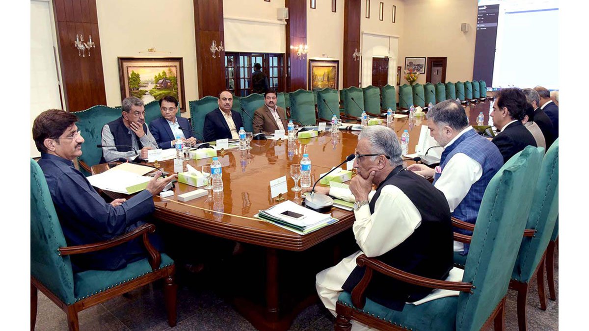
The decision was taken during a high level meeting chaired by Provincial Minister for Revenue Tariq Mehmood Aryani, with senior officials from the Revenue Department and other relevant institutions participating in discussions on the future of digital land governance across the province.
A key feature of the reform package is the introduction of a real time digital alert system that will immediately notify relevant revenue officials whenever an encroachment on government land is detected. The system is intended to enable faster administrative action against illegal occupations while ensuring that cases are monitored continuously.
According to officials, the platform will also introduce an accountability mechanism by digitally recording the tenure of officers responsible for areas where encroachments occur. If action is not taken within the prescribed timeframe, the system will automatically flag the responsible officials, creating a transparent record of administrative inaction and strengthening institutional accountability.
The provincial government also approved the digitisation of government land records as part of a broader effort to improve the management, protection and monitoring of state owned properties. Officials believe that digital records will reduce opportunities for manipulation while providing more accurate and accessible information for both government agencies and citizens.
As part of the public service reforms, the meeting decided to digitise the issuance of fard, allowing citizens to obtain land ownership records electronically through the Dastak App and NADRA's e Sahulat service centres. The initiative is expected to simplify access to land records, reduce processing times and minimise the need for physical visits to revenue offices.
The meeting also approved the use of modern geospatial technologies, including Google Earth and Remote Sensing Geographic Information Systems (RS GIS), for official land marking and site verification. The adoption of satellite based mapping technologies is expected to reduce reliance on manual land demarcation procedures and minimise opportunities for interference in the land marking process.
In another significant reform, the government decided to fully digitise all land mutation processes to improve transparency, enhance record accuracy and reduce delays in property transactions. Revenue officials said the digital workflow would help streamline administrative procedures while strengthening public confidence in the provincial land management system.
The meeting further resolved that pending land dispute cases would be addressed within clearly defined timelines, with revenue officials required to resolve outstanding matters more efficiently. The provincial government said the combined reforms reflect its commitment to modernising the revenue administration, safeguarding public land and delivering faster, technology driven services to citizens across Khyber Pakhtunkhwa.
پشاور | ری نیوز پاکستان
خیبر پختونخوا حکومت نے سرکاری اراضی کے تحفظ، زمینوں کے انتظام میں شفافیت بڑھانے اور ریونیو خدمات کو جدید ٹیکنالوجی سے ہم آہنگ کرنے کے لیے جامع ڈیجیٹل اصلاحات متعارف کرانے کا فیصلہ کیا ہے۔
یہ فیصلے صوبائی وزیر مال طارق محمود کی زیر صدارت ہونے والے ایک اعلیٰ سطح اجلاس میں کیے گئے، جس میں محکمہ مال کے سینئر حکام، متعلقہ اداروں کے نمائندوں اور دیگر اہم سٹیک ہولڈرز نے شرکت کی۔
اصلاحاتی منصوبے کے تحت ایک ریئل ٹائم ڈیجیٹل الرٹ سسٹم تیار کیا جائے گا جو سرکاری اراضی پر کسی بھی قسم کے قبضے کی نشاندہی ہوتے ہی متعلقہ ریونیو افسران کو خودکار طور پر اطلاع دے گا۔ اس نظام کا مقصد غیر قانونی قبضوں کے خلاف فوری انتظامی کارروائی کو یقینی بنانا اور تمام معاملات کی مسلسل نگرانی کرنا ہے۔
حکام کے مطابق نئے نظام میں افسران کے احتساب کا طریقہ کار بھی شامل ہوگا۔ کسی علاقے میں سرکاری زمین پر قبضہ ہونے کی صورت میں سسٹم وہاں تعینات متعلقہ افسر کی مدت تعیناتی کا ریکارڈ محفوظ کرے گا۔ اگر مقررہ وقت میں کارروائی نہ کی گئی تو نظام خودکار طور پر ذمہ دار افسر کی نشاندہی کرتے ہوئے اس کی عدم کارروائی کو ریکارڈ کا حصہ بنا دے گا۔
اجلاس میں سرکاری زمینوں کے ریکارڈ کو مکمل طور پر ڈیجیٹل بنانے کی بھی منظوری دی گئی۔ حکام کا کہنا ہے کہ اس اقدام سے سرکاری املاک کے انتظام، نگرانی اور تحفظ میں بہتری آئے گی، جبکہ ریکارڈ میں رد و بدل اور بے ضابطگیوں کے امکانات کم ہوں گے۔
عوامی سہولت کے لیے فرد کے اجرا کے عمل کو بھی ڈیجیٹل بنانے کا فیصلہ کیا گیا ہے۔ شہری مستقبل میں دستک ایپ اور نادرا کے ای سہولت مراکز کے ذریعے اراضی کی فرد حاصل کر سکیں گے۔ اس اقدام سے ریونیو دفاتر کے چکر کم ہوں گے، وقت کی بچت ہوگی اور شہریوں کو زمین کے ریکارڈ تک زیادہ آسان رسائی حاصل ہوگی۔
اجلاس میں زمین کی نشاندہی اور حد بندی کے لیے گوگل ارتھ اور ریموٹ سینسنگ جیوگرافک انفارمیشن سسٹم، یعنی آر ایس جی آئی ایس، سمیت جدید جغرافیائی ٹیکنالوجیز استعمال کرنے کی بھی منظوری دی گئی۔ حکومت کا کہنا ہے کہ سیٹلائٹ اور ڈیجیٹل نقشہ سازی کے استعمال سے زمین کی نشاندہی کے عمل میں پٹواریوں کی مداخلت کم ہوگی اور حد بندی زیادہ درست اور شفاف بنائی جا سکے گی۔
صوبائی حکومت نے زمینوں کے تمام انتقالات کے عمل کو بھی مکمل طور پر ڈیجیٹل بنانے کا فیصلہ کیا ہے۔ حکام کے مطابق اس سے اراضی لین دین میں شفافیت بڑھے گی، ریکارڈ کی درستگی بہتر ہوگی اور انتقالات کے معاملات میں غیر ضروری تاخیر اور بدعنوانی کے امکانات کم ہوں گے۔
اجلاس میں یہ بھی طے کیا گیا کہ زیر التوا اراضی تنازعات نمٹانے کے لیے ریونیو عملے کو واضح اور مقررہ مدت دی جائے گی۔ متعلقہ افسران کو پابند کیا جائے گا کہ وہ زمین کے تنازعات کو بروقت حل کریں اور غیر ضروری تاخیر سے گریز کریں۔
صوبائی حکومت کے مطابق یہ اصلاحات محکمہ مال کو جدید خطوط پر استوار کرنے، سرکاری زمینوں کو غیر قانونی قبضوں سے محفوظ بنانے اور شہریوں کو تیز، شفاف اور ٹیکنالوجی پر مبنی خدمات فراہم کرنے کی جانب اہم پیش رفت ہیں۔
اسے چاہیں تو میں مزید مختصر نیوز ویب ورژن یا ٹی وی بلیٹن انداز میں بھی ڈھال سکتا ہوں۔